For the 4th of July this year Barb, her daughter Maddy, and I decided to go hiking near Mount Saint Helens. I have been interested in going for years but it just never worked out. This year we made it happen.
Mount Saint Helens exploded on May 18, 1980 and created the largest debris avalanche in recorded history. I heard the boom from it over a 100 miles away in Kirkland Washington. The ash from it fell on our farm in Idaho 275 miles away. I still have a pound or so of the ash that was swept off of the patio from my parents house.
We went on an eight mile (round trip) hike through part of the area destroyed by the high speed avalanche and blast from the explosion. We walked to within five miles of the crater. You might think five miles is a long way away. But the eruption killed trees 17 miles away. The scale of the destruction is amazing.
Taking a picture of something five miles away with the wide angle lens in an ordinary cell phone usually results in the object being invisible. This is not the case with Mount Saint Helens:

With just a 75 mm (moderate telephoto) lens it filled the frame:

With a 130 mm lens I could peer into the edge of the crater and see the rugged terrain:

I used 110 to 160 mm to compress the distance and take some great people pictures:


Maddy took this one of Barb and me with 135 mm telephoto:
With 300 mm the background becomes unrecognizable as a mountain:

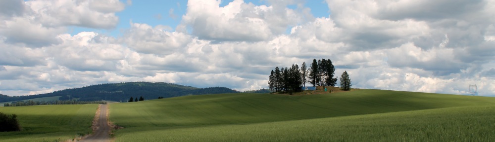
There was much more to the hike than just the crater.
These toothpick looking trees still on the mountain north of Spirit Lake across from the crater are nearly seven miles away:

Even after 34 years Spirit Lake has tens of thousands of trees in it:

There are interesting landscape features:


Other mountains were clearly visible. I think the first one below is Mount Adams and the second is Mount Curtis Gilbert:

[Update: As Defens says in the comments the picture above is of Mount Hood. I didn’t think we could see it from 60 miles away. I also thought it would be behind Mount Saint Helens from our viewpoint. I created a PhotoSynth to prove him wrong and ended up confirming his assertion. It turned out to be a very nice PhotoSynth. I think they have improved it in recent years.]
The trail was interesting but I wouldn’t want to hike it in really hot or cold weather. It was windy and a bit cool on top of the ridges and a bit warm when we were lower and sheltered:


There was a warning near the start of the trail about how people who had problems with heights might have problems with portions of the trail. Barb and Maddy reported some discomfort but surprisingly I did not. The last picture above shows the “ledge” we walked on for probably a third of a mile or so. There were some places that if you stepped off the trail on the downhill side you probably would have slid a few hundred feet to the bottom with a high risk of injury or death.
We really enjoyed the hike and the awesome scenery even if we were a bit sore and tired by the time we got back.
Mt St Helens is a truly awe inspiring experience, and a must visit for everyone in Washington. I’ve been there several times, and it’s always a great trip. Having been stationed at Fairchild AFB when the mountain erupted, i still remember the ash falling like snow, and having to help dig out from under it and going to work that night on the flight line, not knowing if we should be wearing some sort of mask or something. Of course, we weren’t issued anything. I ended up wearing a rag over my face.
Really nice post, Joe! Great pictures, too. That second mountain, below Adams, is Mt. Hood in Oregon – 11,245′.
I worked at Mt. St. Helens in 1986 as part of a geotechnical team that investigated the route for the rebuilt SR-504 highway. This was before a lot of the downed timber had been harvested, but after the elk herds had started multiplying.
We spent several months camped out there, before it had been turned into a national monument. It was great to be able to ride a mountain bike around in the mud flats, etc.
Your photos make me want to return, and probably explore Ape Cave while there.
Thanks. You are correct about it being Mount Hood. I created a Photosynth to prove you wrong and concluded you must be correct.
Illumination Rock, sticking out of the right side (southwestern slope) of the mountain is a key feature.
I heard the boom from it over a 100 miles away in Kirkland Washington.
I was on Mt. Rainier near the base of Little Tahoma when it went off — about 50 miles as the crow flies. Didn’t hear a thing. Kind of funny how that works. I did have a have a “safe” line of sight view of it though. I was stuffing a pack and not looking that direction at the start but another of the guys in the group I was with was looking right at it when it started. He’s “look at that” brought all packing to a stop for a while — until we realized some of it was coming our way and we’d best “get out of Dodge” post haste. Quite the show.
The sound it made was interesting. There is apparently only one recording of it. And if you were closer than about 50 miles (which you were just barely inside that) then you wouldn’t have heard it. But from 50 to 300 miles you could have.